Map showing the moho depth uncertainty, by Finger et al., (2022). For more information please look at the source.
Values are expressed in km.
This dataset is part of the LEAP-RE project collecti...
Global Moho depth map by Szwillus et al., 2019, derived from using a nonstationary kriging algorithm (Risser & Calder, 2017).
Values are expressed in km.
This dataset is part of the LEAP-RE proj...
Map showing the moho depth derived from S-wave seismic tomography data, by Finger et al., (2022). For more information please look at the source.
Values are expressed in km.
This dataset is part...
Shapefile showing the location and type of major faults in Africa.
This dataset is part of the LEAP-RE project collection. For more information visit https://www.leap-re.eu/
Lithosphere thickness map of Africa derived from integrated modeling of elevation and geoid data and thermal analysis, by Globig et al., 2016.
Values are expressed in km.
This dataset is part of...
Map showing global seismic hazard areas. This Global Seismic Hazard Map depicts Peak
Ground Acceleration (PGA) with a 10% chance of exceedance in 50
years. The data is collected as part of the Globa...
Shapefile showing active fault traces of seismic consern globally. The data is compilled as part of the GEM's global Probablistic Seismic Hazard modeling efforts. Includes infromation on fault type, n...
Shapefile showing the location of major faults in the East-African rift system, derived from Chrowicz (2005).
This dataset is part of the LEAP-RE project collection. For more information visit ...
Crustal thickness map of Africa derived from integrated modeling of elevation and geoid data and thermal analysis, by Globig et al., 2016.
Values are expressed in km.
This dataset is part of the...
Shapefile showing the location, relative activity and type of active faults in Africa.
This dataset is part of the LEAP-RE project collection. For more information visit https://www.leap-re.eu/
Gravimetric data recorded between 1979 and 1980 and described in report BRGM 80 SGN 525 GTH. The data contains the Bouguer anomaly (d=2.67), measured G (-978000), topographic correction (d=2.39), posi...
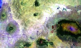
Shapefile showing the location, status, hight and type of volcanoes in Africa that are thought to have been active in the past 10000 years (Holocene). From the Smithsonian Institution, Global Volcanis...
Shapefile showing the presence of volcanic rocks.
This dataset is part of the LEAP-RE project collection. For more information visit https://www.leap-re.eu/
Shapefile showing a lithological map of Africa differentiated by geologic time (intervals) made by the USGS (2001).
This dataset is part of the LEAP-RE project collection. For more information ...