Whether you’re monitoring crops, modelling green energy installations or soil sealing, combatting loss of natural resources or just helping countries meet their Sustainable Development Goals, chances ...
Agricultural drought events can affect large regions across the world. Soil moisture (or soil water content) is an important variable for plant growth, and - together with precipitation and evapotrans...
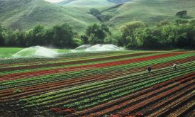
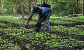
Crop conditions monitoring is highly relevant for food security early warning and response planning in food insecure areas of the world. GEOGLAM is the Group on Earth Observations' Global Agricultural...
Crop conditions monitoring is highly relevant for food security early warning and response planning in food insecure areas of the world. GEOGLAM is the Group on Earth Observations' Global Agricultural...
The Fraction of Photosynthetically Active Radiation Absorbed (FAPAR) is used to track the overall primary productivity associated with atmospheric CO2 fixation. FAPAR anomalies relative to the average...
Evapotranspiration and carbon fluxes between the biosphere and the atmosphere are routinely expressed in terms of the Leaf Area Index (LAI) of the canopy. Monitoring the change of LAI is essential for...
Evapotranspiration and carbon fluxes between the biosphere and the atmosphere are routinely expressed in terms of the Leaf Area Index (LAI) of the canopy. Monitoring the distribution and changes of LA...
The Fraction of Absorbed Photosynthetically Active Radiation (FAPAR) is an Essential Climate Variable that serves as an integrated indicator of the status and health of plant canopies. FAPAR plays a c...
Crop conditions monitoring is highly relevant for food security early warning and response planning in food insecure areas of the world. GEOGLAM is the Group on Earth Observations' Global Agricultural...
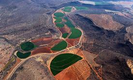
Humans need increasingly more biomass for food, fodder, fiber and energy. In Africa, circa 22% of the vegetated land surface showed a decline or unstable land productivity between 1999 and 2013. Persi...
The land surface forms were identified using the method developed by the Missouri Resource Assessment Partnership (MoRAP). The MoRAP method is an automated land surface form classification based on Ha...
Climate - in terms of temperature, precipitation and continentality - is a primary determinant in the distribution of vegetation. Salvador Rivas-Martinez and Salvador Rivas-Saenz (2004) developed a gl...
The IPC Mapping Tool is an enhanced interactive interface that shows a map of all the countries the IPC works in and allows you to download population data.