This dataset represents a geographic clip to Africa of the
World Database on Protected Areas (WDPA),
which is the authoritative and most complete global dataset on terrestrial and ...
This spatial dataset contains the geographic boundaries and ecological evaluations of 45 Key Landscapes for Conservation and Development (KLCDs) across Sub-Saharan Africa. Building on the K...
Access to piped water reflects the availability of improved water sources directly delivered to households. This layer shows the percentage of people with access to piped water in 2017. Low coverage m...
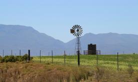
Water Footprint in Africa, considered as the sum of both the green and blue WF and defined as the ratio between evapotranspiration (in m3 per hectare) and crop yield (in ton per hectare). The values a...
In 2020, a group of researchers carried out analysis to examine the importance of Indigenous Peoples’ lands for preserving Intact Forest Landscapes.(Fa et al.2020)They used geospatial data on th...
The Forest Landscape Integrity Index (FLII) is a composite index created to show the degree of forest integrity for 2019.
The authors identified three Forest Integrity categories:
“high ”“medium”...
An intact forest landscape (IFL) is a seamless mosaic of forest and naturally treeless ecosystems with no remotely detected signs of human activity and a minimum area of 500 km2. (Potapov et al.2017) ...
''Intact Forest Landscapes (IFLs) are defined as those with an unfragmented area of at least 500 km2 and which are minimally influenced by human economic activity''.(Thies et al. 2011) IFLs are critic...
The current version of the GDW database (version 1.0) aims to catalogue all types of anthropogenic instream barriers. While initial mapping efforts prioritize major dams that form reservoirs, as well ...
"This map shows, for each grid cell, the Capacity installed [MW] by potential Cooling Absorption System and Refrigeration Absorption System. The maps refer to:
base case scenario;
upside scenario...
"This map shows, for each grid cell, the Capacity installed [MW] by potential Direct Use Systems and High Temperature Heat Pumps. The maps refer to:
base case scenario;
upside scenario;
up up si...
"This map shows, for each grid cell, the Levelized Cost of Heat [c$/kWh] generated by the following systems:
Direct Use;
High Temperature Heat Pump;
The maps refer to:
base case sce...
"This map shows, for each grid cell, the Capacity installed [MW] by potential Binary ORC and Flash Power Plants. The maps refer to:
base case scenario;
upside scenario;
up up side scenario.
T...
"This map shows, for each grid cell, the Levelized Cost of Electricity [c$/kWh] generated by the following systems:
Binary ORC Power Plant;
Flash Power Plant;
The maps refer to:
base...