Skip to main content
EU Science Hub
Africa Knowledge Platform
Main navigation
Home
Datasets
Tools
Stories
Partners
Countries
Tutorials
ArcX
CGLS - Burnt Area Index - Monthly
CGLS - Burnt Area Index - Monthly
Dataset
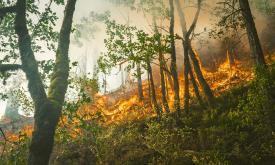
The Copernicus Global Land Service - Burnt Area products depict burn scars, surfaces which have been sufficiently affected by fire to display significant changes in the vegetation cover (destruction o...
Related Policies
SDG 15
Related Topics
Natural Resources
Select for mapping
Read more
Main navigation
User account menu
Language
Main navigation
Home
Datasets
Tools
Stories
Partners
Countries
Tutorials
ArcX
User account menu
Language
en