"This map shows, for each grid cell, the environmental impact in terms of CO₂-equivalent emissions per kilowatt-hour [g CO2 eq/kWh] generated by by the following systems:
Cooling Absorption Syste...
"This map shows, for each grid cell, the Levelized Cost of Cold [c$/kWh] generated by the following systems:
Cooling Absorption System;
Refrigeration Absorption System;
The maps refer t...
This dataset provides the P50 projections for an Organic Rankine Cycle (ORC) geothermal power plant.
Organic Rankine Cycle (ORC) refers to a binary power plant configuration where geothermal fluid ...
This dataset provides the P50 projections for a Direct Heat with Heat Pump geothermal system.
Direct Heat with Heat Pump refers to a scenario where a geothermal system is integrated with an industria...
This dataset provides the P50 projections for a geothermal system utilizing a Chiller unit.
Chiller refers to an absorption chiller or heat pump integrated into the geothermal system. It is used to p...
This layer maps the distribution of diverse geothermal play types categorized by:
Location: Precise spatial boundaries of geothermal provinces.
Geodynamic Setting: Classification by tectonic...
This dataset provides the P50 projections for a Direct Heat geothermal system.
Direct Heat refers to the use of geothermal energy for applications such as space heating, industrial processes, or ag...
Based on the Geothermal Atlas for Africa , the temperature models at 1 km, 2 km, 3 km, and 4 km depth are part of a 3D conductive thermal model of the African lithosphere.
These layers can be d...
Shapefile showing the location of hot springs in Africa derived from multiple sources.
This dataset is part of the LEAP-RE project collection. For more information visit https://www.leap-re.eu/
Shapefile showing the location of oil-rich shales in Egypt, from NARSS.
This dataset is part of the LEAP-RE project collection. For more information visit https://www.leap-re.eu/
This dataset comprises a collection of shapefiles detailing the geographical locations and attributes of various wells across Africa, with a strong focus on geothermal exploration and assessment. Toge...
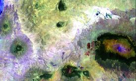
This dataset provides a continent-wide, raster-based spatial representation of Earth's surface heat flow across the African tectonic plate for the year 2013, modeled under a historical baseline scenar...
Shapefile showing the location of thinned lithosphere with thicknesses less than 100 km
This dataset is part of the LEAP-RE project collection. For more information visit https://www.leap-re.eu...