Health

Displaying 1 - 13 of 13
This layer provides estimates of the percentage of children aged 2 to 10 years (PfPR2–10) with detectable Plasmodium falciparum parasites in 2022. The estimates are generated using geostatistical models based on point prevalence surveys, routine surveillance data, and a wide range of geospatial covariates representing mosquito habitat and environmental conditions. The data are available annually from 2000 onward, covering all malaria-endemic countries, at a spatial resolution of 5 × 5 km.
This layer represents the estimated travel time (in hours) by foot to the nearest healthcare facility. The underlying methodology is described in Weiss et al. (2020), which leverages major data collection efforts from OpenStreetMap, Google Maps, and academic sources to compile the most comprehensive global inventory of healthcare facility locations to date. The approach is based on the creation of friction surfaces that quantify the time required to traverse each ~1 km × 1 km pixel of the Earth's surface.
This layer shows the percentage of people with access to any improved sanitation facility, including both piped systems (such as sewer or septic tanks) and non-piped improved options (like ventilated improved pit latrines or composting toilets), in 2017. Improved sanitation is essential for public health, reducing the spread of waterborne diseases and supporting safe and dignified living conditions. Areas with low access highlight the need for expanded basic services and targeted investments in infrastructure.
This layer shows the percentage of stunting among children under 5 years of age, a form of chronic undernutrition reflected in low height-for-age. Stunting can result from prolonged food insecurity, poor maternal health, or inadequate early childhood care. Areas with high stunting rates indicate long-term development challenges and can help guide interventions aimed at improving nutrition, health services, and water and sanitation infrastructure.
Percentage of undernourished people. The higher the incidence of undernourished people the more beneficial decentralised renewable energy solutions may be, in terms of improving both cooking facilities within households and agricultural productivity with positive impacts on nutrition. Thus electricity can be used to make agricultural practices more efficient and refrigerate food produce to store for longer.
Prevalence of underweight (weight-for-age <-2 standard deviation from the median of the World Health Organization (WHO) Child Growth Standards) among children under 5 years of age. Survey estimates are based on standardized methodology using the WHO Child Growth Standards. Global and regional estimates are based on methodology outlined in UNICEF-WHO-The World Bank: Joint child malnutrition estimates - Levels and trends (UNICEF/WHO/WB 2012).
Number of deaths attributable to household air pollution resulting from solid fuels for cooking. Evidence from epidemiological studies have shown that exposure to smoke from incomplete combustion of solid fuels is linked with a range of conditions including acute and chronic respiratory diseases. Of these, evidence for three have been assessed on sufficiently strong basis for inclusion in the burden of disease estimates: acute lower respiratory infections in young children (under 5 years); chronic obstructive pulmonary disease in adults (above 25 years); lung cancer in adults (above 25 years).
Percentage of children 24-35 months who had received all age appropriate vaccinations. The lower the number of vaccinated children, the more beneficial decentralised renewable energy solutions may be in providing electricity to store vaccines in proper refrigerators.

Impacts of the COVID-19 pandemic on migration flows

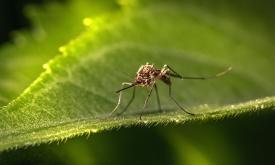
Malaria, a life-threatening disease transmitted by mosquitoes, affects millions of people worldwide. Treatment and prevention efforts such as insecticide-treated mosquito nets and rapid diagnostic tests significantly decreased the number of malaria cases in Africa. This layer displays the change in malaria rates (%) from 2000 to 2015 among children in Sub-Saharan Africa.
Malaria, a life-threatening disease transmitted by mosquitoes, affects millions of people worldwide. This layer highlights malaria rates among children age 2 to 10 in Sub-Saharan Africa in 2015.
Water is a critical natural resource for both natural ecosystems and human subsistence. Some of the most immediate pressures on land that lead to degradation include diversion of surface waters and the removal of groundwater reserves to meet agricultural, industrial and domestic demands. This layer displays the areas of concern for water use related issues derived from the convergence of global evidence of human-environment interactions that can have consequences on land degradation. It highlights areas where the total water withdrawal (by the agriculture, industrial and domestic sectors) exceeds 40% of the total available annual renewable water supply. This layer is part of the World Altas of Desertification

The IPC Mapping Tool is an enhanced interactive interface that shows a map of all the countries the IPC works in and allows you to download population data.