This dataset represents a geographic clip to Africa of the
World Database on Protected Areas (WDPA),
which is the authoritative and most complete global dataset on terrestrial and ...
This spatial dataset contains the geographic boundaries and ecological evaluations of 45 Key Landscapes for Conservation and Development (KLCDs) across Sub-Saharan Africa. Building on the K...
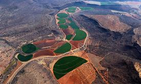
The dataset is the result of a crop simulation and machine learning exercise to evaluate the irrigation potentials in sub-Saharan Africa. Samples of points (representative for each Agro-ecological zon...
This layer shows the percentage of children under 6 months who are exclusively breastfed, meaning they receive only breast milk without any additional food or drink. Exclusive breastfeeding is a key d...
This layer provides estimates of the percentage of children aged 2 to 10 years (PfPR2–10) with detectable Plasmodium falciparum parasites in 2022. The estimates are generated using geostatistical mode...
This layer represents the estimated travel time (in hours) by foot to the nearest primary school. The accessibility map is generated using a well-established geospatial methodology that integrates roa...
This layer represents the estimated travel time (in hours) by foot to the nearest healthcare facility. The underlying methodology is described in Weiss et al. (2020), which leverages major data collec...
This layer shows the estimated number of deaths per 1,000 live births among children under 5 years of age (in 2017) — a key indicator of child survival and overall health system performance. High unde...
This layer shows the percentage of children under 5 experiencing severe wasting (in 2019) — the most critical form of acute malnutrition. These children face a significantly higher risk of mortality ...
This layer shows the percentage of children under 5 years of age (in 2019) who are underweight, based on low weight-for-age. Underweight is a composite indicator capturing both chronic and acute under...
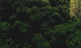
Crop conditions monitoring is highly relevant for food security early warning and response planning in food-insecure areas of the world. GEOGLAM (the Group on Earth Observations' Global Agricultural M...
Crop conditions monitoring is highly relevant for food security early warning and response planning in food-insecure areas of the world. GEOGLAM (the Group on Earth Observations' Global Agricult...
The conservation analyst is a web-based tool that integrates and weighs multiple criteria for spatial conservation planning allowing for the identification and selection of unprotected la...
The current version of the GDW database (version 1.0) aims to catalogue all types of anthropogenic instream barriers. While initial mapping efforts prioritize major dams that form reservoirs, as well ...
Modern energy services are crucial to human well-being and to a country’s economic development; and yet 1.2 billion people are without access to electricity. It is recognized that the central grid is ...
This dataset represents a geographic clip to Africa of the
World Database on Protected Areas (WDPA),
which is the authoritative and most complete global dataset on terrestrial and ...