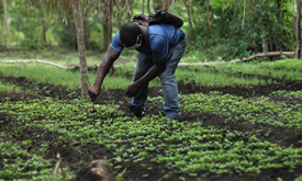
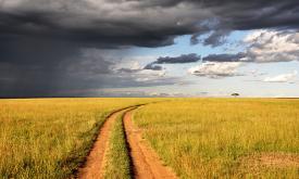
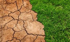
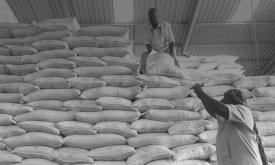
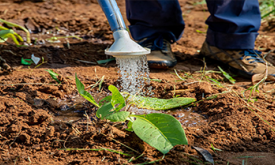
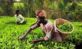
GOAL 02: Zero hunger

End hunger, achieve food security and improved nutrition and promote sustainable agriculture

Datasets
Understanding why and where humanitarian disasters are likely to occur is a fundamental step in saving lives and promoting sustainable development. The INFORM Risk Index is a global, open-source risk ...
Understanding why and where humanitarian disasters are likely to occur is a fundamental step in saving lives and promoting sustainable development. The main focus of humanitarian organizations is peop...
Food crisis response planning can save lives if put in place in a timely manner. To do this, decision makers must be warned of climate extreme events impacting agricultural production. The Anomaly hot...
Air condition indicates whether the air quality is fit for human use and ecosystems. This indicator is based on PM2.5 concentrations. PM 2.5 is the annual global surface concentration (micrograms per ...
This indicator assesses the potential threat of wildfires due to fire weather intensity. Wildfires impose significant risks to human lives and economic activities. In extreme fire weather events, stro...
The erosive force of rainfall (rainfall erosivity) is a major driver of soil, nutrient losses worldwide and an important input for soil erosion assessments models. This map shows the geographical dist...
This indicator assesses whether there is enough natural habitat surrounding cropland to support natural pollination. Up to two-thirds of all crops require some degree of animal pollination to reach th...
The erosive force of rainfall (rainfall erosivity) is a major driver of soil, nutrient losses worldwide and an important input for soil erosion assessments models. This map shows the geographical dist...
This indicator refers to the stock status of marine fish. As the largest traded food commodity in the world, seafood provides sustenance to billions of people worldwide. More than 85% of the world's f...
In most people's mind, soil would not figure highly in a list of the natural resources of Africa. However, healthy and fertile soils are the cornerstones of food security, key environmental services, ...
Soil condition indicates whether soil can perform basic functions to benefit human use and ecosystems alike. This indicator is based on soil organic carbon (SOC) content. SOC is the main component of ...
This indicator assesses the number of occurrences of herbicide resistant weeds. Herbicide resistance is the ability of a weed to survive an herbicide application that had been used to contain that pop...
Understanding why and where humanitarian disasters are likely to occur is a fundamental step in saving lives and promoting sustainable development. The main focus of humanitarian organizations is peop...
This indicator assesses the potential threat from transboundary animal and plant pests and diseases. As genetic and species diversity is lost and ecosystems are degraded, the complexity of the overall...
By detecting areas where agricultural production deficits might occur, it is possible to prevent food security crises and anticipate response planning. To do this, we need accurate and reliable inform...
Côte d'Ivoire and Ghana are the main largest producers of cocoa in the world. However, the cultivation of this crop has led to the loss of vast tracts of forest areas in both countries. Efficient and ...
By detecting areas where agricultural production deficits might occur, it is possible to prevent food security crises and anticipate response planning. To do this, we need accurate and reliable inform...
Crop conditions monitoring is highly relevant for food security early warning and response planning in food insecure areas of the world. GEOGLAM is the Group on Earth Observations' Global Agricultural...
Ecosystem condition indicates whether the natural environment is intact and connected. Poor ecosystem condition can result in businesses having restricted access in the long-term to the quantity and q...
This indicator assesses the predicted maximum wind speed (mph) on a 50-year return period. Storms can impact companies and value chains through a variety of ways, including building and property damag...
This indicator assesses the threat of extreme heat during a 5-year return period. Extreme heat has an obvious impact on human health, but it is also relevant to a wide array of economic activities and...
This indicator assesses the potential threat of rainfall- and earthquake-triggered landslides. Landslides impose significant risks to human lives and economic activities. Landslides have become more p...
Stories
These interactive stories are aimed at EU policymakers and African stakeholders. All stories are relevant to all African countries, but some present country specific data.
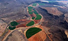
Measuring food insecurity in Africa, identifying root causes, and finding long-term solutions.
Monitoring climate extremes impact on Agriculture in Southern Africa with the Anomaly Hotspots of Agricultural Production (ASAP).
Presenting the eStation, a software deployed in Africa to acquire and process Earth Observation data, and two of its applications for fishing (in Tanzania) and farming (in the Sahel). ...
Tools
This selection of analytical tools allows you to interact with detailed maps and statistics. All tools are relevant to all African countries, and some have a global dimension.
The IPC Mapping Tool is an enhanced interactive interface that shows a map of all the countries the IPC works in and allows you to download population data.