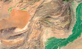
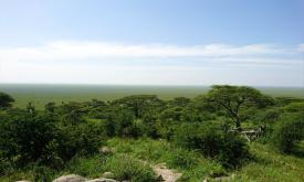
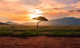
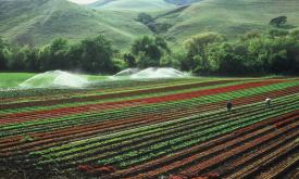
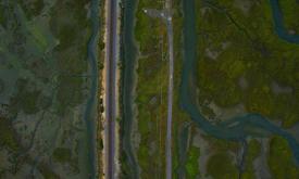
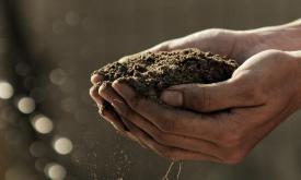
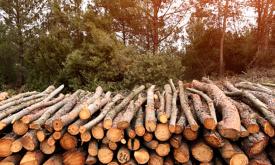
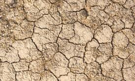
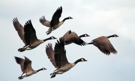
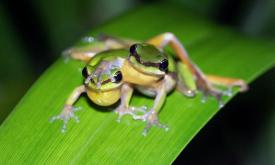
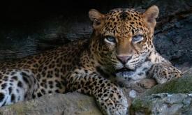
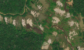
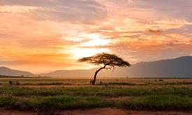
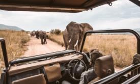
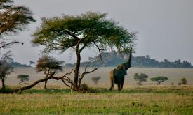
GOAL 15: Life on land

Protect, restore and promote sustainable use of terrestrial ecosystems, sustainably manage forests, combat desertification, and halt and reverse land degradation and halt biodiversity loss.

Datasets
The African Development Corridors published by Thorn, J.P.R., Bignoli, D.J., Mwangi, B. et al. The African Development Corridors Database: a new tool to assess the impacts of infrastructure investment...
The large-scale expansion of built infrastructure is profoundly reshaping the geographies of Africa, generating lock-in patterns of development for future generations. Understanding the impact of thes...
This indicator measures the availability of natural and cultural resources. Some industries, such as tourism, real estate and education, can depend highly on the presence of touristic valuable land or...
Humans need increasingly more biomass for food, fodder, fiber and energy. In Africa, circa 22% of the vegetated land surface showed a decline or unstable land productivity between 1999 and 2013. Persi...
Water scarcity refers to the physical abundance or lack of freshwater resources. It can significantly impact business such as production/supply chain disruption, higher operating costs, and growth con...
The Global 200 is the list of ecoregions identified by WWF, the global conservation organization, as priorities for conservation. According to WWF, an ecoregion is defined as a "relatively large unit ...
Water is a critical natural resource for both natural ecosystems and human subsistence. Some of the most immediate pressures on land that lead to degradation include diversion of surface waters and th...
Understanding why and where humanitarian disasters are likely to occur is a fundamental step in saving lives and promoting sustainable development. The main focus of humanitarian organizations is peop...
Land cover is defined as the physical material at the surface of the earth, usually documented via the interpretation of earth observations. Common land cover types include trees, grass, bare ground, ...
Protected areas have long played a crucial role in protecting natural landscapes and wildlife, and many consider them to be one of the most effective tools in protecting biodiversity. The Internationa...
The Fire Information for Resource Management System (FIRMS) of the National Aeronautics and Space Administration (NASA) uses satellite observations to detect active fires and thermal anomalies. They d...
Fire is a natural part of all ecosystems. Wildfires have been burning vegetation and shaping landscapes far longer than people have been on Earth. However, changes in fire frequency and timing can res...
Air condition indicates whether the air quality is fit for human use and ecosystems. This indicator is based on PM2.5 concentrations. PM 2.5 is the annual global surface concentration (micrograms per ...
The Copernicus Global Land Service - Burnt Area products depict burn scars, surfaces which have been sufficiently affected by fire to display significant changes in the vegetation cover (destruction o...
Global data sets on the geographic distribution of livestock are essential for diverse applications in agricultural socio-economics, food security, environmental impact assessment and epidemiology.Thi...
This indicator assesses the potential threat of wildfires due to fire weather intensity. Wildfires impose significant risks to human lives and economic activities. In extreme fire weather events, stro...
Tropical moist forests have a huge environmental value. They play an important role in biodiversity conservation, terrestrial carbon cycle, hydrological regimes, indigenous population subsistence and ...
A hybrid transition map is available at a resolution of 10m for the period from 1990 to 2022. This beta version combines the recently updated TMF map for the year 2022, derived from Landsat images at ...
Tropical moist forests have a huge environmental value. They play an important role in biodiversity conservation, terrestrial carbon cycle, hydrological regimes, indigenous population subsistence and ...
The erosive force of rainfall (rainfall erosivity) is a major driver of soil, nutrient losses worldwide and an important input for soil erosion assessments models. This map shows the geographical dist...
River floods are recognized as one of the major causes of economic damages and loss of human lives worldwide. Quantifying flood hazard is an essential component of resilience planning, prevention meas...
The erosive force of rainfall (rainfall erosivity) is a major driver of soil, nutrient losses worldwide and an important input for soil erosion assessments models. This map shows the geographical dist...
The Fire Information for Resource Management System (FIRMS) of the National Aeronautics and Space Administration (NASA) uses satellite observations to detect active fires and thermal anomalies. They d...
The erosive force of rainfall (rainfall erosivity) is a major driver of soil, nutrient losses worldwide and an important input for soil erosion assessments models. This map shows the geographical dist...
Humans need increasingly more biomass for food, fodder, fiber and energy. In Africa, circa 22% of the vegetated land surface showed a decline or unstable land productivity between 1999 and 2013. Persi...
The Fire Information for Resource Management System (FIRMS) of the National Aeronautics and Space Administration (NASA) uses satellite observations to detect active fires and thermal anomalies. They d...
The erosive force of rainfall (rainfall erosivity) is a major driver of soil, nutrient losses worldwide and an important input for soil erosion assessments models. This map shows the geographical dist...
This indicator assesses whether there is enough natural habitat surrounding cropland to support natural pollination. Up to two-thirds of all crops require some degree of animal pollination to reach th...
The Fraction of Photosynthetically Active Radiation Absorbed (FAPAR) is used to track the overall primary productivity associated with atmospheric CO2 fixation. FAPAR anomalies relative to the average...
Aridity represents the ‘dryness’ of the climate. Dry areas have a higher potential for land degradation. This layer displays the areas of concern for aridity related issues derived from the convergenc...
Evapotranspiration and carbon fluxes between the biosphere and the atmosphere are routinely expressed in terms of the Leaf Area Index (LAI) of the canopy. Monitoring the change of LAI is essential for...
Humans need increasingly more biomass for food, fodder, fibre and energy. Meeting these demands changes global ecosystems. Tracking changes in total biomass production or land productivity is an essen...
Forests worldwide are in a state of flux, with accelerating losses in some regions and gains in others. Given the recognized importance of forest ecosystem services, quantification of global forest ex...
This indicator is based on nutrient, pesticide and air pollution. Pollution is an important driver of biodiversity and ecosystem change throughout all biomes. While terrestrial ecosystems have been af...
Changes in vegetation biomass are critical in assessing land degradation. Climate variations, alone or in combination with human-induced land use and land change, can affect biomass productivity and m...
The Global Human Settlement Layer (GHSL) project produces global spatial information about the human presence on the planet. It benefits many applications ranging from disaster risk reduction and post...
HydroBASINS represents a series of vectorized polygon layers that depict sub-basin boundaries at a global scale. The goal of this product is to provide a seamless global coverage of consistently sized...
This indicator measures cropland expansion, river fragmentation and pressures on marine environments through shipping and direct human impact. Land- and sea-use change is the major human influence on ...
Critical natural assets are defined as the natural and semi-natural terrestrial and aquatic ecosystems required to maintain 12 of nature’s ‘local’ contributions to people (local NCP) in the ocean (blu...
HydroRIVERS represents a vectorized line network of all global rivers that have a catchment area of at least 10 km² or an average river flow of at least 0.1 m³/sec, or both. HydroRIVERS has been extra...
Irrigation enables farmers to increase crop production by reducing their dependence on natural rainfall. It is considered a vital part of ensuring food security in the future. Yet it also causes exten...
Agricultural drought events can affect large regions across the world. Soil moisture (or soil water content) is an important variable for plant growth, and - together with precipitation and evapotrans...
In most people's mind, soil would not figure highly in a list of the natural resources of Africa. However, healthy and fertile soils are the cornerstones of food security, key environmental services, ...
Soil condition indicates whether soil can perform basic functions to benefit human use and ecosystems alike. This indicator is based on soil organic carbon (SOC) content. SOC is the main component of ...
Soil organic carbon (SOC) is the carbon that remains in the soil after partial decomposition of any material produced by living organisms. It constitutes a key element of the global carbon cycle throu...
This indicator assesses the number of occurrences of herbicide resistant weeds. Herbicide resistance is the ability of a weed to survive an herbicide application that had been used to contain that pop...
Droughts affect millions of people in the world each year and have long-lasting socioeconomic impacts. They can occur over most parts of the world, even in wet and humid regions, and can profoundly im...
The application of fertiliser is a key component in increasing agricultural production. However, there are thresholds beyond which the cost of inputs fails to lead to corresponding increases in yield....
This indicator assesses the potential threat from transboundary animal and plant pests and diseases. As genetic and species diversity is lost and ecosystems are degraded, the complexity of the overall...
Droughts affect millions of people in the world each year and have long-lasting socioeconomic impacts. They can occur over most parts of the world, even in wet and humid regions, and can profoundly im...
Smallholder farmers have limited access to capital and are reluctant to trade their low-risk system (low input and low yield) to a high-risk system (high input and potentially higher yields). But Insu...
Given the massive scale of livestock production systems, it is unlikely that any other single human activity has a larger environmental impact on the terrestrial land mass of the planet. As the world’...
Oil seed crops, especially oil palm, are among the most rapidly expanding agricultural land uses, and their expansion is known to cause significant environmental damage. Accordingly, these crops often...
Crop conditions monitoring is highly relevant for food security early warning and response planning in food insecure areas of the world. GEOGLAM is the Group on Earth Observations' Global Agricultural...
Roots are a long term and stable carbon sink, accounting for about 0.4 of the above ground biomass across biogeographical regions. Well established and developed root systems provide various ecosystem...
Côte d'Ivoire and Ghana are the main largest producers of cocoa in the world. However, the cultivation of this crop has led to the loss of vast tracts of forest areas in both countries. Efficient and ...
Africa’s extraordinary richness in biodiversity and ecosystem services comprises a strategic asset for sustainable development. Yet the decline and loss of biodiversity hampers the sustainable social ...
Carbon storage in biomass (biological material) is a key link in the global carbon cycle, and consequently for climate change mitigation. Forests in particular are an important carbon sink that help r...
This map provides a spatially explicit characterization of 47 terrestrial habitat types, as defined in the International Union for Conservation of Nature (IUCN) habitat classification scheme, which is...
Habitat fragmentation occurs when natural habitat is broken up by non-natural land uses. For this layer, land fragmentation is expressed as the Natural Land Cover Pattern Index (NLPI), which classifie...
This map provides a spatially explicit characterization of 47 terrestrial habitat types, as defined in the International Union for Conservation of Nature (IUCN) habitat classification scheme, which is...
The Dead Wood Carbon and Litter Carbon pools have been estimated at global level as constant fractions of ESA Biomass CCI Above Ground Biomass (AGB), v.3 (2018) using a lookup table based on global ec...
Organisms and non-living elements of the environment such as climate, soil, and water are connected through the movement of nutrients and energy in ecosystems. Ecosystems represent specific areas wher...
Africa’s extraordinary richness in biodiversity and ecosystem services comprises a strategic asset for sustainable development. Yet the decline and loss of biodiversity hampers the sustainable social ...
Whether you’re monitoring crops, modelling green energy installations or soil sealing, combatting loss of natural resources or just helping countries meet their Sustainable Development Goals, chances ...
The RESOLVE Ecoregions dataset, updated in 2017, offers a depiction of the 846 terrestrial ecoregions that represent our planet.
Africa’s extraordinary richness in biodiversity and ecosystem services comprises a strategic asset for sustainable development. Yet the decline and loss of biodiversity hampers the sustainable social ...
The availability and quantity of observational species occurrence records have greatly increased due to technological advancements and the rise of online portals, such as the Global Biodiversity Infor...
A global strategy to conserve biodiversity must aim to protect representative examples of all of the world’s ecosystems, as well as those areas that contain exceptional concentrations of species and e...
The United Nations Educational, Scientific and Cultural Organization (UNESCO) seeks to encourage the identification, protection and preservation of natural heritage around the world considered to be o...
Africa’s extraordinary richness in biodiversity and ecosystem services comprises a strategic asset for sustainable development. Yet the decline and loss of biodiversity hampers the sustainable social ...
The Global 200 is the list of ecoregions identified by WWF, the global conservation organization, as priorities for conservation. According to WWF, an ecoregion is defined as a "relatively large unit ...
Africa’s extraordinary richness in biodiversity and ecosystem services comprises a strategic asset for sustainable development. Yet the decline and loss of biodiversity hampers the sustainable social ...
This indicator measures forest canopy loss. Land- and sea-use change is the major human influence on habitats. Habitat loss is one of the biggest threats to biodiversity and is the number one reason s...
Forest canopy height measures the average height of the tree canopy in 2012. This dataset is created by integrating broadscale optical remotely sensed data at 30-metre spatial resolution with on-the-g...
Mapping ongoing project activities in the field of conservation in protected areas is essential to identify the various actors and to identify the areas where information and actors are scarce. The ai...
Some areas in Africa represent spectacular, still viable examples of Africa’s wildlife and wild places. They are of such outstanding importance and value that they should be conserved at all costs and...
Africa’s extraordinary richness in biodiversity and ecosystem services comprises a strategic asset for sustainable development. Yet the decline and loss of biodiversity hampers the sustainable social ...
Displays areas where the geographic range of two or more endemic bird species overlaps. While many bird species are widespread, over 2,500 are endemic and restricted to an area smaller than 5 million ...
Key Biodiversity Areas (KBAs) are the most important places in the world for species and their habitats. Faced with a global environmental crisis we need to focus our collective efforts on conserving ...
Ecosystem condition indicates whether the natural environment is intact and connected. Poor ecosystem condition can result in businesses having restricted access in the long-term to the quantity and q...
Africa’s extraordinary richness in biodiversity and ecosystem services comprises a strategic asset for sustainable development. Yet the decline and loss of biodiversity hampers the sustainable social ...
Forests worldwide are in a state of flux, with accelerating losses in some regions and gains in others. Given the recognized importance of forest ecosystem services, quantification of global forest ex...
Evapotranspiration and carbon fluxes between the biosphere and the atmosphere are routinely expressed in terms of the Leaf Area Index (LAI) of the canopy. Monitoring the distribution and changes of LA...
The Fraction of Absorbed Photosynthetically Active Radiation (FAPAR) is an Essential Climate Variable that serves as an integrated indicator of the status and health of plant canopies. FAPAR plays a c...
The EC JRC global map of forest cover provides a spatially explicit representation of forest presence and absence for the year 2020 at 10m spatial resolution.The year 2020 corresponds to the cut-off d...
The CO2 fixed by photosynthesis is one of the most important components of the carbon cycle. Forests play a key role in this process. They represent large and persistent carbon sinks. Tree carbon stoc...
Africa is very rich in biodiversity and is the last place on Earth with a significant assemblage of large mammals. This natural richness, accumulated over millions of years, coupled with the wealth of...
Physical Risk is driven by the ways in which a business depends on nature and can be affected by both natural and human-induced conditions of land- and seascapes. It comprises the risk categories: 1) ...
The data provided here are the result of a time-series analysis of carbon density change (in Mg/ha) between 2003-2014 spanning tropical America, Africa, and Asia (23.45 N lat.-23.45 S lat.). The origi...
Biodiversity and the ecosystem services it supports are not only the foundation for our life on Earth, but also critical to the livelihoods and well-being of people everywhere. Africa’s extraordinary ...
The Biodiversity Intactness Index shows the modelled average abundance of originally-present species in a grid cell, as a percentage, relative to their abundance in an intact ecosystem. Originally ava...
Park managers in many countries across Africa need to monitor and understand their parks features and overall health. They can rely on the highly detailed land cover information offered by the Coperni...
Biomes are distinct biological communities (collection of plants and animals) that have formed in response to a shared physical climate. The 11 major terrestrial biomes found in Africa (out of 14 worl...
Biomes are distinct biological communities (collection of plants and animals) that have formed in response to a shared physical climate. They are distinguished by characteristic temperatures and amoun...
Biodiversity hotspots are the Earth’s most biologically rich—yet heavily threatened—terrestrial regions. These are regions where success in conserving species can have an enormous impact in securing o...
Whether you’re monitoring crops, modelling green energy installations or soil sealing, combatting loss of natural resources or just helping countries meet their Sustainable Development Goals, chances ...
The NASA Making Earth System Data Records for Use in Research Environments (MEaSUREs) Shuttle Radar Topography Mission (SRTM) global 1 arc second (~30 metre) DEM is archived and distributed by the Lan...
The Dead Wood Carbon and Litter Carbon pools have been estimated at global level as constant fractions of ESA Biomass CCI Above Ground Biomass (AGB), v.3 (2018) using a lookup table based on global ec...
This indicator assesses the predicted maximum wind speed (mph) on a 50-year return period. Storms can impact companies and value chains through a variety of ways, including building and property damag...
Critical natural assets are defined as the natural and semi-natural terrestrial and aquatic ecosystems required to maintain 12 of nature’s ‘local’ contributions to people (local NCP) on land. 12 Local...
This indicator assesses the threat of extreme heat during a 5-year return period. Extreme heat has an obvious impact on human health, but it is also relevant to a wide array of economic activities and...
This indicator assesses the potential threat of rainfall- and earthquake-triggered landslides. Landslides impose significant risks to human lives and economic activities. Landslides have become more p...
Many businesses rely on ecosystem services that regulate or support production processes, including the cultivation of crops or breeding of animals. Declines in enabling ecosystem services such as soi...
This indicator refers to the unavailability of commercially harvested species. Wild species are used in many applications, including for medicinal, cosmetic, aromatic and genetic purposes. They are us...
Timber availability refers to the physical abundance and accessibility of realizable timber provisions. As timber is used for house building, furniture and in food storage, water and agricultural infr...
The Topographic Position dataset identifies two classes: uplands and lowlands/depressions. This is a derivative product of the Compound Topographic Index (CTI) which is a topographically derived measu...
The Great Green Wall (GGW) Initiative comprises 21 African countries and is implemented under the coordination of the African Union.
The Sahel is an area that, over time, has had multiple definitions, climatic-botanical and political: its limits have been traced in very different ways. Even the usage of this name and its delimitati...
Copernicus is the European flagship programme for monitoring the Earth. Data is collected by Earth observation satellites and sensors on the earth’s surface. The Copernicus Land Monitoring Service pro...
Where are the best places to spot the most requested wildlife-watching species? This grid layer presents a richness index of top wildlife watching species/groups, including rhinos, elephants, lions, l...
Forests are the most biologically diverse land ecosystems and are critical for sustaining local and global livelihoods. Deforestation can be considered a type of land degradation when forest ecosystem...
The Africa Topographic Moisture Potential layer classifies the landscape of Africa as either upland or lowland (and other depressions) area. It was produced as part of the USGS’s Africa Ecosystems Map...
The Africa Surficial Lithology layer maps the geology of Africa into 20 classes based on the bedrock type and the distribution of unconsolidated surface material. It shows the distribution of the key ...
Smallholder farmers and pastoralists have restricted access to capital and may not have the capacity to invest in management practices that mitigate land degradation. This layer displays the areas of ...
The human imprint on the planet has a major impact on the functioning of the Earth system. Because the impact on the environment is closely intertwined with population dynamics, it is important to mon...
Some extraordinary changes have occurred across the globe over the past decades regarding human habitation. Globally, between 1975 and 2015 built-up areas increased by approximately 250 %, while popul...
According to UN estimates, the global population will increase by 2.4 billion between 2015 and 2050. Of this, an overwhelming 50 % will be concentrated in Africa (1.3 billion). There could be up to fo...
At any given place on Earth, complex human-environment interactions are at play. They include differing rates and magnitudes of drivers (e.g. overgrazing, climate change, agricultural practices) and d...
ESA WorldCover 2021. Global land cover product at 10 m resolution for 2021 based on Sentinel-1 and 2 data.
ESA WorldCover 2020. Global land cover product at 10 m resolution for 2021 based on Sentinel-1 and 2 data.
Stories
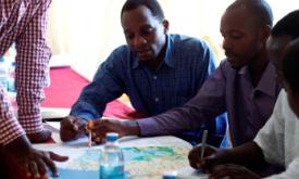
These interactive stories are aimed at EU policymakers and African stakeholders. All stories are relevant to all African countries, but some present country specific data.
Monitoring compliance of gold mines in Republic of Congo using earth observation.
Participatory approaches for better decision making that benefits the biodiversity, the climate and the people.
Presenting the eStation, a software deployed in Africa to acquire and process Earth Observation data, and two of its applications for fishing (in Tanzania) and farming (in the Sahel). ...
Tools
This selection of analytical tools allows you to interact with detailed maps and statistics. All tools are relevant to all African countries, and some have a global dimension.
Protected areas in Africa play a critical role in biodiversity conservation, supporting livelihoods, and mitigating climate change. This tool offers a comprehensive analysis of the dynami...
An interactive map showing data from the Global Human Settlement Layer (GHSL) 2023 produced by the European Commission Joint Research Center
The conservation analyst is a web-based tool that integrates and weighs multiple criteria for spatial conservation planning allowing for the identification and selection of unprotected la...
The distribution of dryland trees and their density, cover, size, mass and carbon content are not well known at sub-continental to continental scales. This information is important for ec...
eConservation provides critical information on funding from public donors worldwide to support biodiversity conservation. The aim is to better understand who is funding what and where@wit...
The Wildfire Information System application aims at providing a synoptic view of wildfire trends@seasonality and spatial arrangement of fires and burnt areas per country and sub-country l...
The Key Biodiversity Areas (KBAs) are sites that contribute significantly to the global persistence of biodiversity in terrestrial@freshwater and marine environments.